Mobile Mapping
Fast, precise und comprehensive survey of of elongated objects
dhp:i offers highly accurate measurement with the use of a very precise mobile mapping system. For the first time, elongated facilities (such as roads, tunnels, bridges or channel) can be detected using a variety of platforms in great detail. As a result, a laser scanner acquisition produces a precise, digital and especially comprehensive image of your object. From this, two-dimensional As-Built plans, sections and floor plans can be calculated. Additionally three-dimensional models and visualizations can be produced easily out of the resulting data basis.

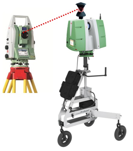
The high accuracy is achieved by the integration of so-called IMUs (Inertial Measurement Unit) satellite measurements and conventional terrestrial surveys using total stations. The latter provides a higher integrity and system stability, as well as a great accuracy potential.
The IMU consists of several sensors which measure acceleration and rotation. Out of this, conclusions about the orientation of the scanner can be drawn. With the help of GNSS or total stations, the position is detected, so the system can always calculate the location of the scanner at the time of measurement. The scanner then creates a 3D point cloud by high-resolution and non-contact measurement (also see: 3D Laserscanning).
In summary, kinematic scanning provides high accuracy and resolution with a significant increased efficiency in contrast to conventional scanning.


